In Part 2 of our hail series, we focus on storm patterns. If you missed Part 1, click here to read it.
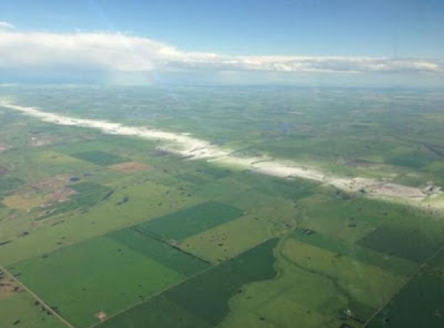
Viewed from the air, we can see that hail falls along paths known as hail swaths. These can be quite small – a hectare or so (a few acres) in area – or quite large, 16 kilometres (10 miles) wide by 160 kilometres (100 miles) long. Hail swaths that persist over large distances are often produced by supercell thunderstorms.

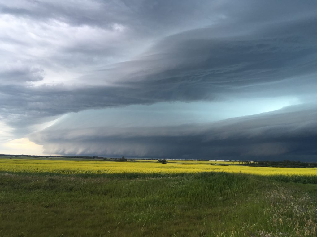
Generally, supercell thunderstorms are the most frequent hail producers and produce the largest hail sizes. Supercells are rotating thunderstorms that almost always produce hail. Supercells have the greatest potential for damaging hail because of their stronger updrafts, allowing hail stones to remain lofted inside the storm cloud for longer periods of time. They are also longer-lived storms, allowing them to cause significant hail damage over longer distances.

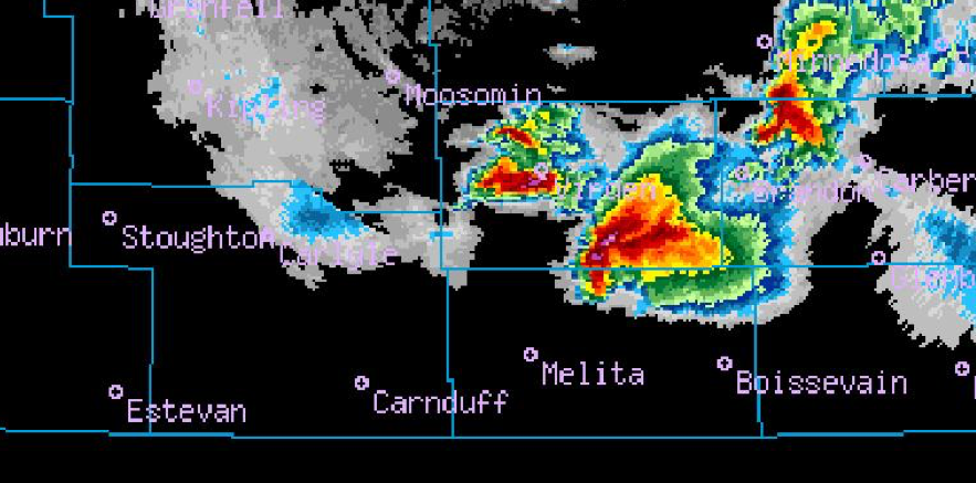
The radar image above shows an example of a supercell thunderstorm southwest of Brandon, Manitoba on June 23, 2007. Not only did the storm produce tornadoes, but it also produced large hail. Notice the V-shape appearance of the storm on the radar image and the hook-like feature on its southern side. These are some of the features on radar often associated with supercells. The region above the hook with the strongest radar returns (bright purples) is the most likely location of very large hail, sometimes as large as softballs.
Other thunderstorm types, such as single-cell or multi-cell storms, usually do not produce hail as large as in supercells. Single-cell storms tend to last less than an hour before fizzling out. This reduces their ability to cause widespread damage and their weaker updrafts tend to produce smaller hail, as compared with supercell thunderstorms. This is not to say that severe hail can never occur under single-cell thunderstorms, but the incidence of large hail is less frequent.

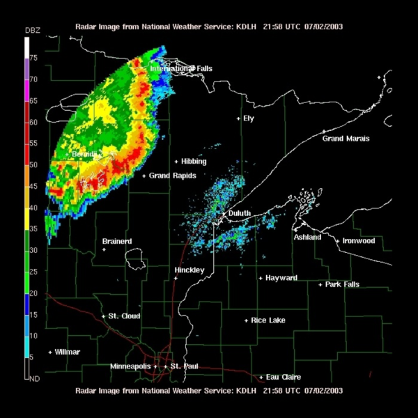
Multi-cell storms last longer because they are continually regenerated along the storm’s boundary of outflow winds. However, their updrafts are also often weaker than in supercell thunderstorms. Squall lines (pictured above), which are lines of multi-cell thunderstorms, often occur late in the day or overnight, producing damaging straight-line winds. Again, large hail can still occur in multi-cell storms but it tends to be less frequent and lesser in size.

Hail outbreaks can occur if multiple supercell thunderstorms develop along a frontal boundary (such as a cold front). Once these storms develop, large hail will begin to fall not too long after the storms develop (sometimes in as little as 30 minutes), given their intense updrafts. As the day wears on, these storms will either die out when the sun sets, or if the atmospheric conditions are right, the storms may develop into a line of storms, such as a squall line, which races eastward producing damaging straight-line winds and smaller hail.
If you’d like to continue the conversation, feel free to contact us at info@weatherlogics.com. You can also visit our insurance page for more information about our hail data. We would love to show you how our hail data and forecasts can help you manage your weather risk.
In our final post of this hail series next week we will discuss how Weatherlogics forecasts hail storms and impacts of these storms on various industries.


