The Prairies are in the midst of record cold weather. Alberta has seen air temperatures plummet as low as -50 C, causing record electrical use. In Saskatchewan, there have been widespread temperatures in the -40s. Manitoba has been the “warmest” of the three Prairie provinces, but temperatures have still regularly dropped in the -20s and -30s. This has a lot of people wondering, what happened to El Niño?
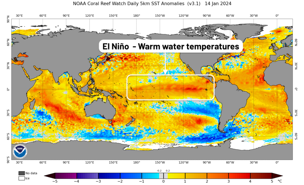
Unlike some winter phenomena, like the Polar Vortex, El Niño is not weather in itself. El Niño represents warmer-than-normal water temperatures in the central Pacific Ocean (along the equator). You may have also heard of La Niña, when the same waters are colder than normal. Because the Pacific Ocean is such a massive body of water, these ocean temperatures can affect global weather patterns.
Across western Canada, El Niño typically brings warmer and drier winters. We saw this in December, when most of western Canada had one of its warmest Decembers ever. Warm weather patterns during Prairie winters usually mean the jet stream is weaker. This allows mild Pacific air to flow across the Prairies, along with a lack of regular low-pressure systems.
The recent cold snap made it seem like El Niño suddenly disappeared. In fact, El Niño hasn’t gone anywhere. The waters in the central Pacific do not change quickly. Typically, an El Niño event will last for roughly one year, but every event is different. The current El Niño began in April 2023 and appears to have reached its maximum intensity in December. Usually, El Niño events will either weaken or dissipate during the spring. That is what we expect in this case, with El Niño continuing for the rest of this winter, before ending sometime in the spring or summer.
This begs the question; How can we get such cold weather while El Niño is still in place? Because El Niño represents water temperatures, it is indirectly correlated with weather. Unlike the Polar Vortex, which is an actual weather feature representing extreme cold air, El Niño is an influence on weather, not weather itself. The influence of El Niño comes and goes during winter, but overall we expect it to cause a warmer and drier winter on average. El Niño is also not the only influence on our weather. Other factors can cause colder patterns to take hold, even during an El Niño event.
To conclude, El Niño is still alive and well. We continue to expect this winter to average warmer and drier overall when the number are tallied. It looks like warmer weather will return to the Prairies for the last 7-10 days of January.