Available in the Weatherlogics App
for All Subscriptions
Weatherlogics’ Radar Map* – check out the NEW radar layer in the app
The updated layer now displays past and future radar images
*previously named Interactive Map
⛈️ Getting Started
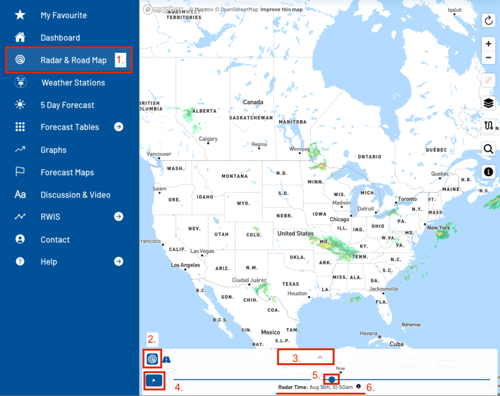
Here are some steps to get started viewing radar for your current location:
- In the Weatherlogics’ app navigation menu, select the Radar & Road Map *previously named Interactive Map, Road Forecasts are a premium subscription feature
- If not already selected, click on the radar icon – upper-left of the bottom panel – to turn on the layer
- Click on the upper part of the panel, to expand / collapse the point forecast and radar legend information
- Click the play/pause button to start and stop the radar animation
- Drag the circular time control on the timeline to view the radar layer at a specific time
- Click on the selected time label for a larger view of the time
Weatherlogics’ Radar Map
- Radar coverage for North America and the northern parts of Central America
- High resolution, colourized precipitation image layers
- rain, snow, freezing rain, ice pellets
- New past and future radar layers
- *future radar is available for premium subscribers
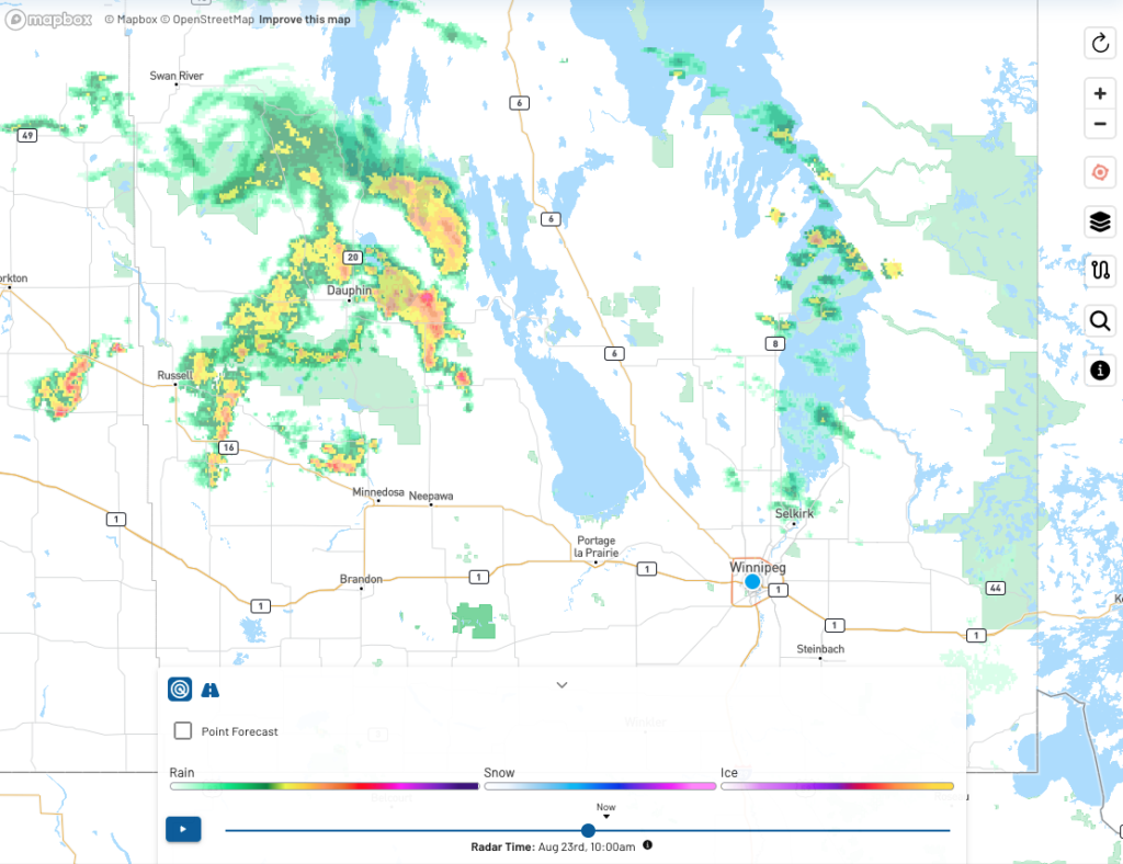
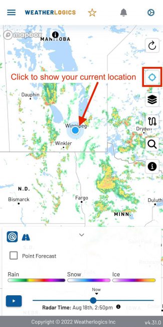
- Zoom in to view road labels or use the locate icon to view your current location on the map
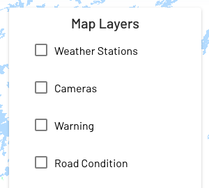

- Use the radar layer in combination with other map layers
- weather stations, road cameras, weather warnings, road condition, and point forecast
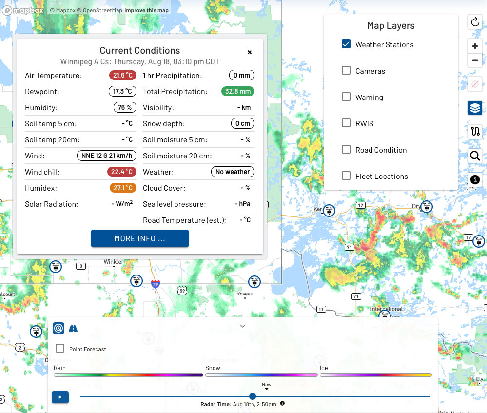
- Weather Stations and Radar
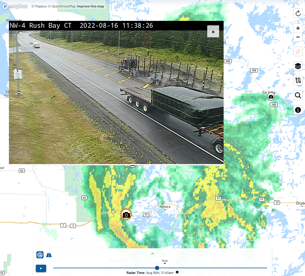
- Road Cameras and Radar
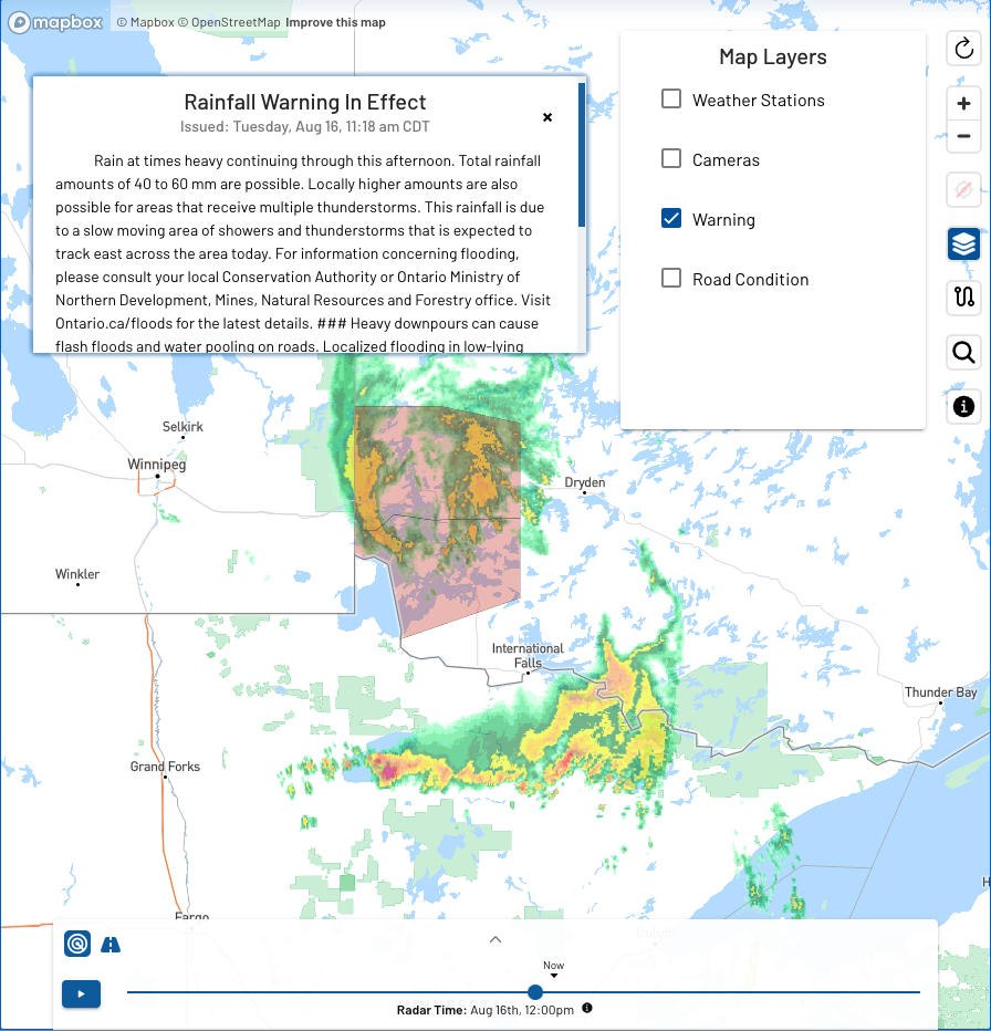
- Weather Warnings and Radar
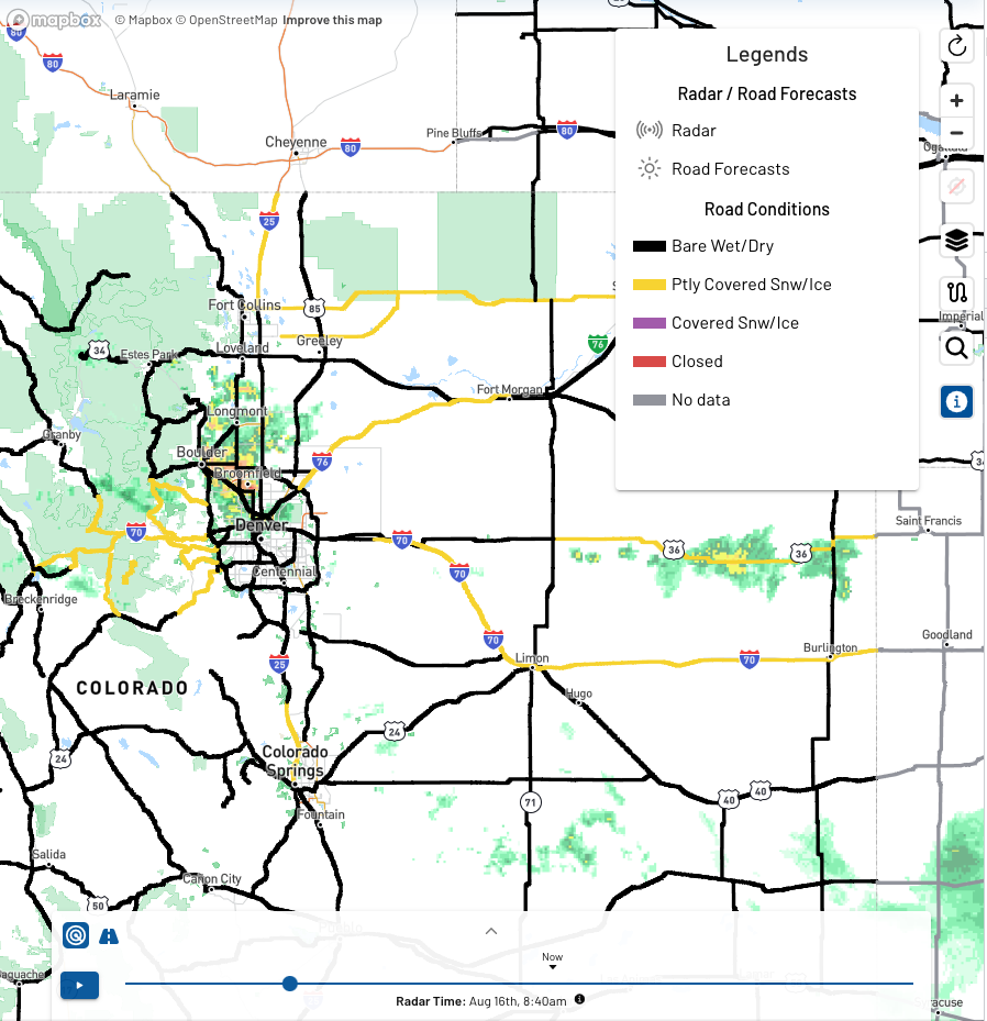
- Road Condition and Radar
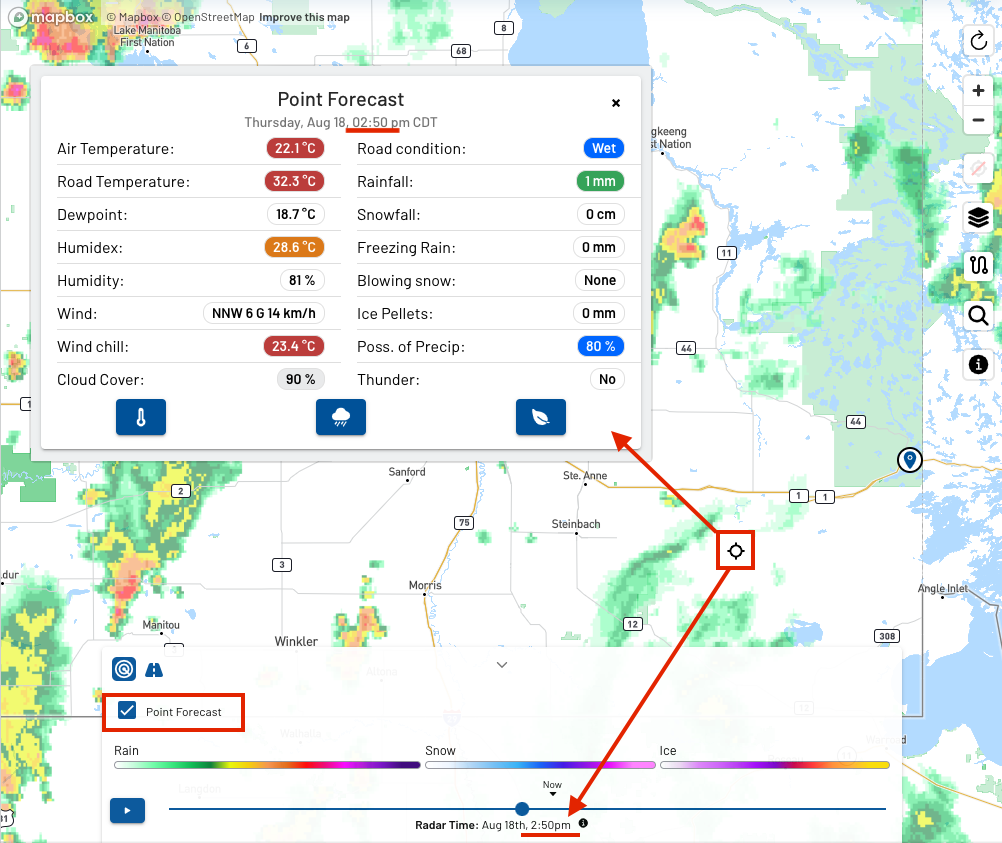
- Point Forecast and Radar

