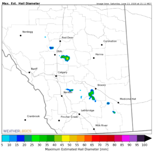
Storm Maps
After severe weather events, map layers showing storm footprints of hail, wind, forest fires, rain or tornadoes can be very useful to understand the event and verify claims.
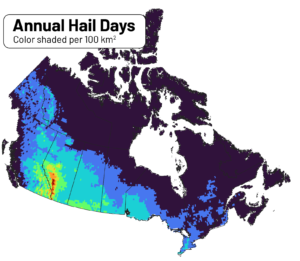
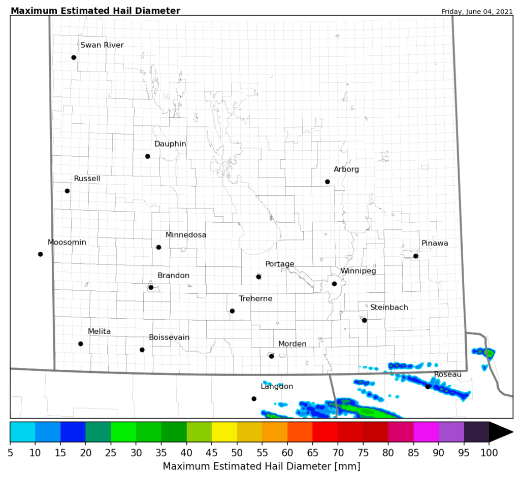
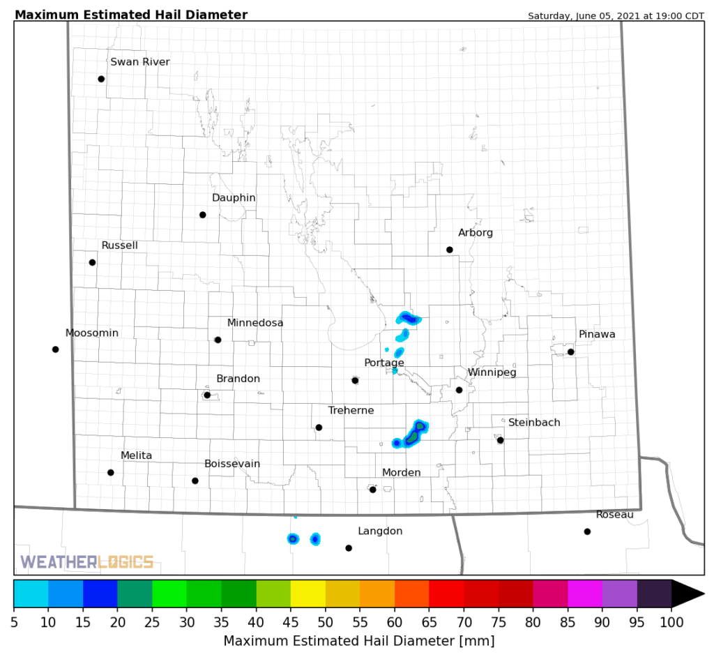
Hail Risk
Using our extensive archive of historical hail data, Weatherlogics has produced a gridded hail climatology - this helps insurers identify hail risk areas.
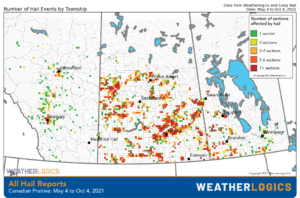
Ground Truth
Weatherlogics maintains an extensive database of ground-truth hail, wind, tornado, and rainfall data for all of Canada. These custom datasets provide ground-measurements of actual events.
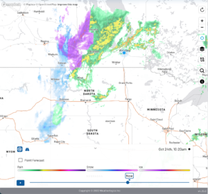
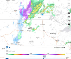
Tracking & Alerts
Our meteorologists provide clients with real-time storm tracking and alerting. This allows you to monitor severe events as they happen.
"Co-op Hail and Weatherlogics have a strong partnership in the crop hail insurance industry. We have been working together for the last number of years to provide next day hailstorm occurrences and ground truthing throughout Saskatchewan and Manitoba. This provides potential crop damage claim areas and severity levels as well. This partnership provides valuable information for both our field adjusters and office staff."

"Palliser Insurance has partnered with Weatherlogics to provide hail maps and weather data to its customers."